
Global Navigation Satellite Systems (GNSS) are used by the GeoExplorerIQ system for fully automated deformation monitoring applications. The U.S. Global Positioning System (GPS) is the most commonly used GNSS and the terms GPS and GNSS are used interchangeably in this chapter.
Definitions
The following definitions highlight important terms used throughout this chapter:
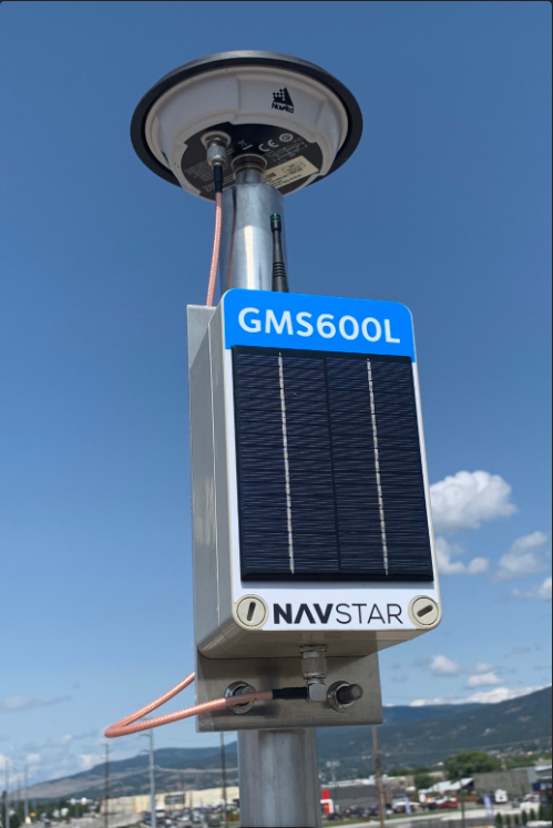
- GPS Unit: A system of electronic components that include power systems, a GNSS receiver, a communications system, relevant antennae and cables.
- Data Type: A Data Type is a measurable property of a sensor. For example 3D Displacement would be a Data Type for a GPS sensor. Similarly Temperature would be a Data Type for a weather station. Any variable that a sensor can measure directly, or that can be calculated from sensor raw data is called a Data Type. These are the values that can be used for alarming, graphing, etc.
- Reset Measurement: This is a measurement that has been flagged as being a 'reset' reading. Typically this indicates that the GPS unit was reset or moved and that velocities cannot be calculated until a sufficient number of new measurements have been processed.
- Fixed Basestation: A GPS Unit that has been configured as a Fixed Basestation will have a known coordinate for the GPS antenna. These sensors are assumed to be stable and fixed in position. Basestation’s are used as the reference position by which to calculate rover positions.
- Floating Basestation: A GPS unit that has been configured as a Floating Basestation will have a navigated/ambiguous coordinate for the GPS antenna. These sensors may be located on stable or unstable monuments but critically, the coordinate may be recalculated with regular occurrence.
- Rover: A GPS Unit that has been configured as a Rover has an unknown position. These sensors are used for monitoring deformation.
- Baseline: When GPS data is processed, the result is a 3D Baseline between a Basestation and a Rover. The Baseline is a three dimensional vector (dx, dy, dz). Rover coordinates are determined by fixing the Basestation end of the Baseline to the known coordinates of the Basestation.
- Post-Processing Position (PPP): A survey methodology that gathers observations from two locations over a period of time between to calculate a baseline. As the name suggests, this methodology is completed after all observations are made which is a retrospective update to a coordinate.
- Real Time Kinematic (RTK): A survey methodology that provides positional information in real time by utilising corrections from a fixed basestation to improve the positional quality.
Notes on Data Source settings:
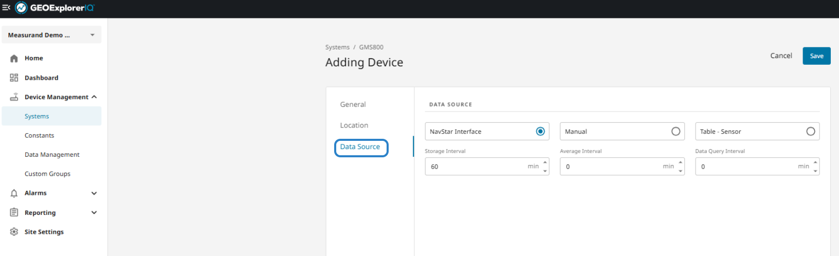
The field Data Source will not affect some GNSS sensors, Interval settings should be done on the General Tab for legacy sensors and for GMS600 the interval is defined on the sensor itself.
The Storage Interval setting defines the minimum frequency that will be stored for any sensor type. The GNSS Rover sensor has the interval setting which defines how often post-processing happens and also the amount of raw data used. That doesn’t actually define an averaging interval as there will still just be a single solution for that chunk of raw data.
You can set a minimum raw data percentage on the GNSS Rover sensors that will block post-processing if there isn’t enough raw data. That can help avoid spikes in the post-processed data.
On the GMS600’s the wakeup interval is defined by switches on the hardware. Changing the storage interval will just block storage if the unit is configured to read more frequently than the storage interval (this can be useful if you want to evaluate alarms more frequently than you want to store data).
On the GMS600L’s, the data storage interval is synchronized to the hardware so they can be set remotely.
Note: Please ensure you identify what type of GPS systems are in use at your site before editing or establishing new sensors. Either, RTK or Post-Processing Positions will be in use, which require very different methodologies.